


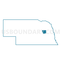
Joliet Precinct, Platte County, Nebraska
About
Outline

Summary
| Unique Area Identifier | 613732 |
| Name | Joliet Precinct |
| County | Platte County |
| State | Nebraska |
| Area (square miles) | 35.97 |
| Land Area (square miles) | 35.96 |
| Water Area (square miles) | 0.02 |
| % of Land Area | 99.95 |
| % of Water Area | 0.05 |
| Latitude of the Internal Point | 41.61779430 |
| Longtitude of the Internal Point | -97.64895470 |
Maps


Graphs
Select a template below for downloading or customizing gragh for Joliet Precinct, Platte County, Nebraska


Neighbors
Neighoring Voting District (by Name) Neighboring Voting District on the Map
- Granville Precinct, Platte County, NE
- Lost Creek/Burrows Precinct, Platte County, NE
- Oconee/Monroe Precinct, Platte County, NE
- St. Bernard Precinct, Platte County, NE
- Walker/Woodville Precinct, Platte County, NE
Top 10 Neighboring County Subdivision (by Population) Neighboring County Subdivision on the Map
- Granville township, Platte County, NE (981)
- Lost Creek township, Platte County, NE (517)
- St. Bernard township, Platte County, NE (502)
- Walker township, Platte County, NE (247)
- Burrows township, Platte County, NE (244)
- Monroe township, Platte County, NE (164)
- Woodville township, Platte County, NE (155)
- Joliet township, Platte County, NE (140)
Top 10 Neighboring Unified School District (by Population) Neighboring Unified School District on the Map
- Lakeview Community Schools, NE (5,188)
- Twin Rivers Public Schools, NE (2,933)
- Humphrey Public Schools, NE (2,250)
- Newman Grove Public Schools, NE (1,406)
- St. Edward Public Schools, NE (1,061)